
Find your way around
Park Map & Gallery
The site map for Beaufort Waterway RV Park, with zoom, pan and download controls — plus a gallery of the park as it looks today.
Site map
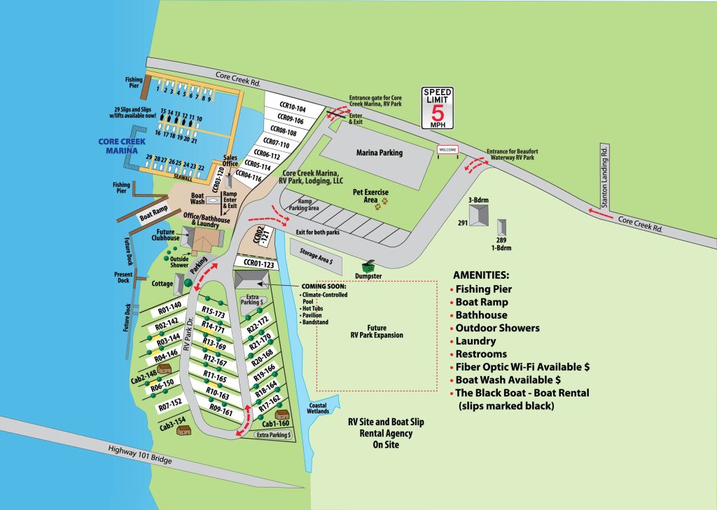
Beaufort Waterway RV Park site map
Use the controls to zoom and pan, or open the original image at full resolution. A written list of facilities follows for anyone who would rather not use the map.
The map reproduces the park layout as published by the owner. Areas marked as future or coming-soon on the original drawing are planned, not built — confirm with the office before booking around them. Site-number hotspots are not enabled until the owner verifies positions and identifiers against the renumbering.
Text alternative
Facilities and how the park is laid out
Everything marked on the map, described in words.
- Office and welcome centre near the park entrance
- Bathhouse with showers and restrooms
- Laundry room with coin-operated washer and dryer
- Private boat ramp with trailer parking
- Two fishing piers, one with a cleaning station
- Waterfront RV sites along the Intracoastal Waterway
- Pull-through RV sites in the interior rows
- Premium back-in sites with concrete pads and fire pits
- Cozy Cabins on the Coast at sites 16, 5 and 8
- Core Creek Marina RV sites along the marina basin
- Open green areas for walking pets